New from our Medieval Research Blog: "Reading the Medieval Landscape through Archaeological Maps of the Nineteenth and Early Twentieth Centuries"
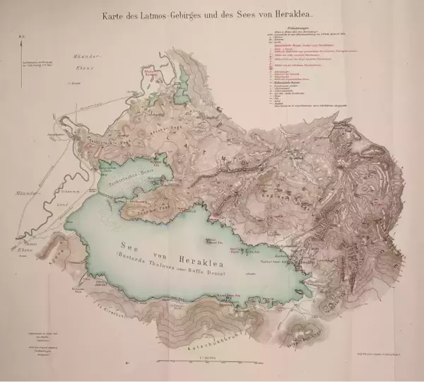
There are few things I like to do more than pouring over an old map. For those working on the Maeander River Valley (modern Büyük Menderes in western Türkiye), we are spoiled by old maps from archaeological surveys and excavations from the nineteenth and early twentieth centuries. Unlike earlier maps, these maps surveyed and composed for archaeological purposes were more detailed and often more accurate in their spatial representation. In this blog, I want to introduce two fascinating maps.
First, is the Lyncker map, named for the military officer Karl Lyncker who carried out the bulk of the investigations around 1908 and 1909. The map was produced for the archaeological exploration and excavations conducted in the valley by Theodor Wiegand. This map is best understood as a composite map, including the map of Lake Bafa by the military officer Walther von Marées in 1906 (Fig. 1) and the map of the Milesian peninsula by the mine surveyor Paul Wilski in 1900 (Fig. 2). Alfred Philippson, a geologist, would conduct his own surveys and produce his own map in 1910 (Fig. 3). Later, Philippson would compile all the earlier maps and publish them as a composite map in 1936 in the series of volumes of the Miletus excavation.[1]
This is an excerpt from “Reading the Medieval Landscape through Archaeological Maps of the Nineteenth and Early Twentieth Centuries" by Tyler Wolford, Ph.D., last year's Byzantine Postdoctoral Studies Fellow. Read the full piece.